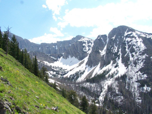
 On July 3rd, 2011, two friends and I took a day hike up the trail leading to the Rumble Lakes and Holland Peak, the highest in the Swan Range at 9,356 ft (2,852 m). This may not seem like a very high elevation, but we gained 3,500 ft of elevation in roughly 5 hours with lunch and some exploring. Not terrible for a few out of shape hikers with the added factor of snow.
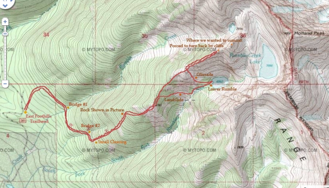 Getting to the Starting Line: On Highway 83 in Condon, Montana at about mile marker 40 plus or minus one mile, there is a church, the Condon Community Church. Directly across from the church is a road named Rumble Creek Road. Follow this main road until the very end. Toward the end, there is a lookout tower that the road winds around. After this, it gets pretty rough so drive slow unless of course you enjoy coming back from a hard hike to see a flat tire. There will be a trailhead sign that will only show Trail 192, East Foothills Trail. They no longer maintain the Rumble trail, and it is also not on the newer topography maps. Just follow 192 watching out for the landmarks that I’ve shown on the map. As of this hike, there is a downed tree about 5 feet up the beginning of the Rumble Trail so don’t think that it isn’t the right one if you see it. Rumble Trail is the only obviously used trail that leads off of 192 for quite a while.
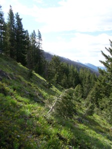
This was our first high elevation hike of the season, and we were clearly not in shape. After crossing two bridges, and turning left, just before a clearing, the next few miles up was a goat trail that felt straight up. Switchbacks, what switchbacks? There was plenty of brush and trees blockading the trail, some requiring detours because they were so thick. This was likely because it was early in the season, and it doesn’t actually have a sign or a trail head to signify where to go, meaning the forest service likely doesn’t maintain it often, especially when much of the destination is covered in snow this time of year.
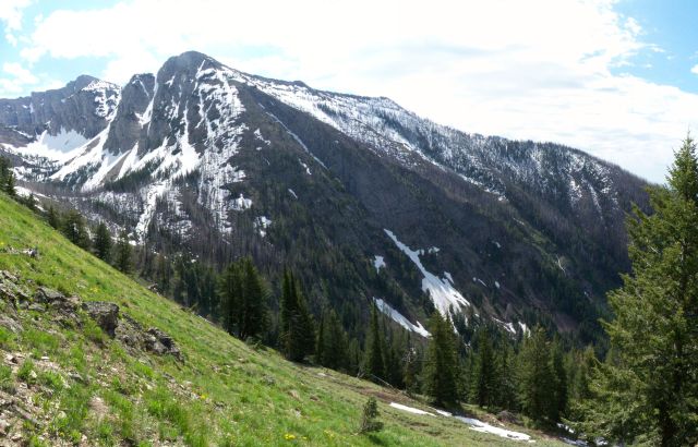
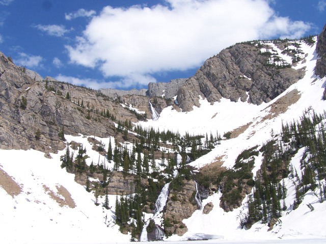
After getting to the top of the ridge, things became a little easier, but we were still plagued with cramps around our kneecaps with muscles we didn’t even know existed. Difficult, but highly rewarding. After breaking through the main treeline we were face to face with the absolutely incredible Holland Peak (not shown below) and the wall of mountain rock surrounding it.
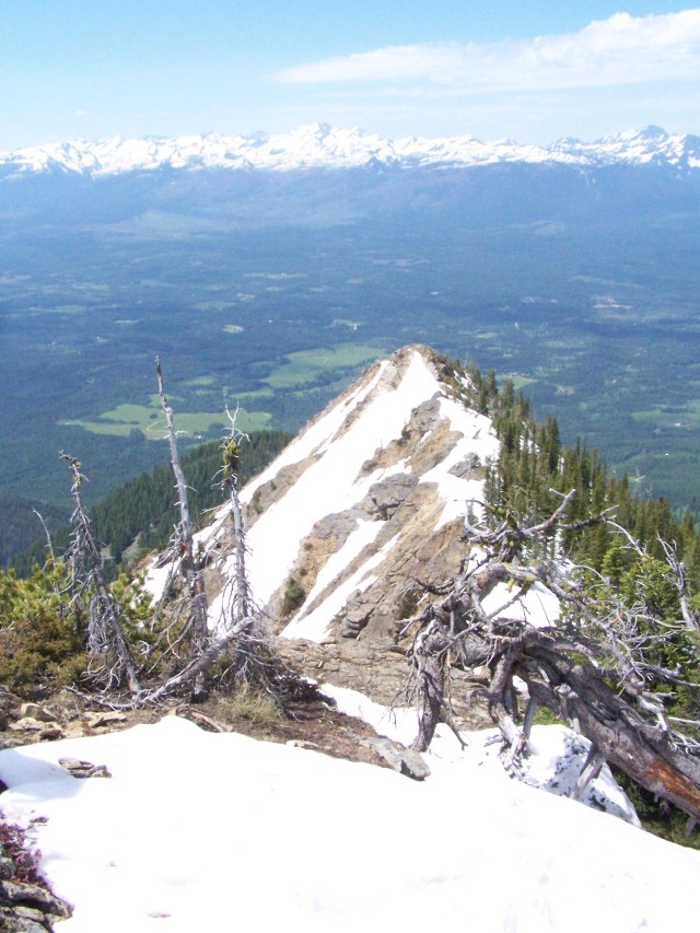
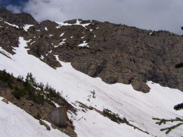
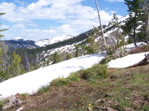 We then traversed up the ridge in hopes of finding the trail to the lower lake, but we did not. Soon finding snow to slip on was easy so it was time to break out the ice axe as well as my new Scarpa boots.
From as soon as we broke through the treeline until we arrived at the highest point nature would allow us, it was an incredible view.
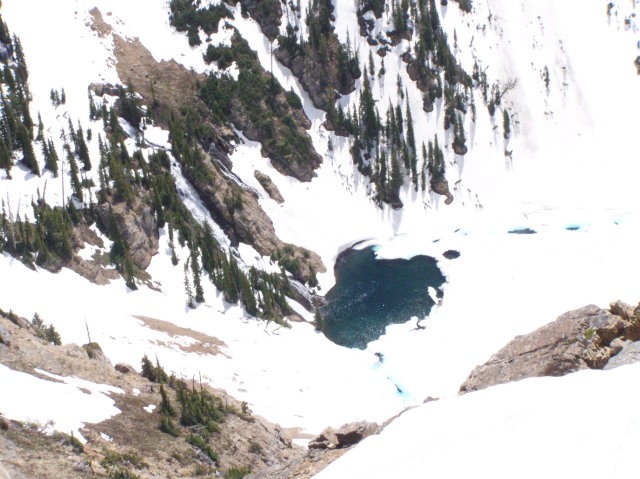
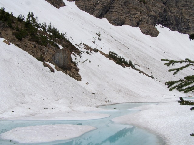
We then descended the ridge until we were above Lower Rumble. Then a glissade was in order for a fast descent to the lake. One of my group members used the same avalanche shovel I reviewed to “glissade” down the snow covered scree. Not only did it look fun, but also painful when he went into a hole in the snow. From a high speed to a dead stop apparently did not give him the most invigorating feeling. But after he recovered, he slid down past where the snow had melted and ran out into bear grass. It seems that bear grass does not slow down the fast and the furious on snow shovels because he had to get off before nearing a small cliff. As I watched him continue his “glissade” beyond the snow, I had to worry but also laugh because I didn’t expect him to continue with such haste through the grass.
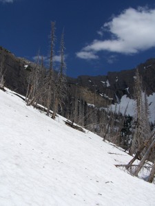 After the glissade, in order to get to the lower lake, we hiked through an old burn which looked very unique with snow blanketing the ground surrounding it. It looked very picturesque. I wish I had a high quality video camera to show its ambiance.
Sidehilling on the snow was considerably easier than on grass and dirt due to the ability of making one’s own level steps as they compact the snow. Also I had been reading about how snow conditions change drastically throughout the day. By this time it was too easy to manipulate the snow. When I dug my pick into the snow and dragged it, it offered little resistance. I was surprised at how much harder self arrest would be later in the day which is often when mountaineers fall because they are descending. I suppose the best advice is, “Don’t fall, or dont fall far!”
After taking a break to absorb of the beauty, I spotted a thunderstorm rolling in so it was decided that it was time to depart.
With snow covering the trail, we followed the creek down until we hit bare ground. While trying to maintain elevation because we were too tired by this time to enjoy much more climbing, we sidehilled until we saw the trail.
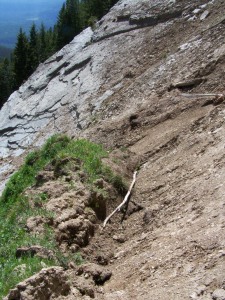
Here you may be able to spot the mudslide beyond the rocks. We didn’t at the time until we went over them. I was only thinking of taking pictures until we were actually in danger.
Beyond this rock face was the biggest threat all day despite cliffs, snowy ridges, and cornices. A sheer face of dried and consolidated mud with sharp shale rocks glued to the surface lied ahead. There was nearly nothing to hold onto, and we had to cross about 30 feet of it. If any of us would have fallen, it would have meant severe scraping down a 60 foot run out of this stuff. Just by feeling it with our hands, we could tell that the remains of the landslide would rip us to shreds.
After Johnny, the shovel rider, crossed very carefully, I followed his line and had a move that made my blood pressure rise. I was so near slipping that if I had leaned even a few degrees backwards, I would have fallen and slid down the sandpaper of a mountain.
Once I found some vegetation to hold onto, I looked back at the last member of our group, who was frozen in place because there was no advancing holds to reach. He is at least 4 inches shorter than both Johnny and myself, making the moves we made too risky for him. Thank God I brought about 20 ft of 6mm accessory cord. I took off my pack, grabbed the rope, found a secure position for myself and threw it to him.
We managed to get across the landslide, but not without a reminder of how easy it is to get into serious trouble.
After regaining our nerves, we progressed through some fairly dense forest with snow, again making it challenging to follow the trail. We managed to get beyond the snow, change socks and get out of those mountaineering boots. Then we basically ran down the ridge until we made it back to the truck.
It was a great first elevation hike. After bagging that one, I felt ready for more within a few days. The next mountain I have my eye on is Lindy Peak…

Reblogged this on Travels with Mary and commented:
Great hike and fabulous photos! Thanks!
How many miles is it from the trailhead to the lake?
I honestly couldn’t tell you. There isn’t a trailhead sign so you’d have to use a topo map to figure it out.
Hi! Sorry I didn’t see your reply until now. Your point is totally valid. It’s easy for me to get stuck in the “this belongs to me” mentality, wherein I worry about tourists or out-of-staters finding and then ruining my favorite spots. But if they have the wherewithal to be safe and find the trail, I can’t exactly deny them that experience. I suppose it’s inevitable that the prettier trails and lakes will slowly gain popularity — that’s just the way of things. I’m all of a sudden reminded of my dad complaining about various strip malls and subdivisions that didn’t exist when he was a kid, but which I took for granted.
Anyway, I look forward to future blog posts from you! (And I completely agree that the difficulty of the hike makes the end result that much sweeter.)
I’m really glad you could understand the other side of it, but either way you look at it, there are pros and cons. You had an extremely valid point. I had a bit of a moral dilemma a few weeks back trying to decide if I should keep writing about all these places because more people will inevitably go to them. At the same time it stimulates the economy of my home town, which needs it so badly if it will continue to sustain my family’s business. In a way, showing “foreigners” our paradise is good, but also bad. I’ve decided to continue writing about the awesome places I’ve been to, but I will never say how good the fishing is! Haha And I have a ton of hikes that I haven’t made the time to write about, but hopefully soon I’ll get writing.
Hi! I’m a fellow Montanan, and I enjoyed your story. I was at Lower Rumble Lake from Aug. 6 to Aug. 13 of last year — I have to admit that the landslide you describe herein was equally terrifying to our party. I’ve been up there each year for the past while, so I know that slide-out must be less than a year old.
I also have a favor to ask, but feel free to ignore it. I’ve noted over the past several years that more and more people are showing up at Rumble Lake, to the point that it is starting to affect the quality of the trails and the environment by the campsites. I would humbly request that in the spirit of keeping this pristine area protected for all Montanans that you would consider removing all references to it — I know for a fact that several parties I met up there last year found out about this lake’s existence on the internet, and were quite unprepared for the difficulty and danger of the hike. I worry for these “day-hikers” who would read a site like this and in turn bring their life or someone else’s life into danger. Thanks! Happy hiking!
Hi, it’s nice to know that there are some other local Montanans checking out the site, and I apologize for the lateness of my reply. As you had said yourself, “over the past several years that more and more people are showing up…” I can’t just point to my article for this happening. Word of mouth has definitely spread. There are guidebooks in every place of business in Condon. I’ve lived here my entire life. There are other numerous articles on Rumble Lake in Summit Post as well as mentioning in online hiking forums. What I will do though is continue writing articles about other areas in hopes that my readers will be drawn to them instead. Currently I don’t have a large following because I haven’t had time to continue writing articles so the people who do read that article are reading it because they likely googled “rumble lake” because someone told them about it.
Also, I did my best to make it clear in my article that the landslide crossing is very dangerous. If they cannot judge the difficulty themselves then they shouldn’t be hiking.
With the whole tourist-trodden landscape thing, I totally agree with you about that. I don’t want a ton of people in my secret spots either. Odds are, they’ll find them if they have the enthusiasm and energy to make it up that far. That is why hiking and climbing is so rewarding when it’s tough. When you get to the top of the peak, you know that few have stood where you are standing. If it’s too difficult for them, more than likely they’ll turn around and head for shade. If they can get there, then they should be allowed to experience what we have.